Skip to main contentSkip to footer

Topographical Survey

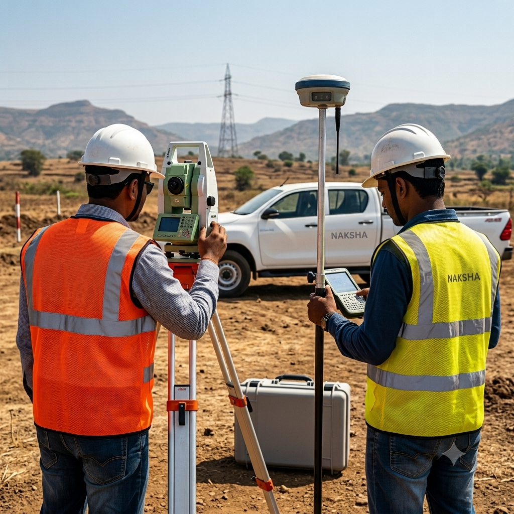
A topographic survey is the foundational step in any solar park project. This service involves detailed mapping of the land’s surface features, both natural and man-made, including elevation, slopes, existing structures, and vegetation. Accurate topographic data allows solar park developers to make informed decisions about site layout, drainage, and construction planning.
We use advanced DGPS and GIS technologies to perform precise topographic surveys, ensuring accurate and actionable data for site planning.

Geotechnical investigation
/Soil testing

Geotechnical Investigation & Soil Testing Services
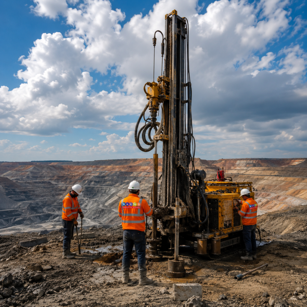
At Naksha Solutions , we provide end-to-end  geotechnical investigations and soil testing services  essential for sustainable infrastructure development. With over a decade of experience, our services ensure precise data collection, analysis, and reporting to help clients make informed decisions for safe and efficient project execution. We provide IS standards and NABL-accredited report procedures to meet the highest quality benchmarks.

soil testing Services:

  • Drilling & Sample Collection in Any Terrain
  • Detailed Soil Testing Reports
  • Soil Bearing Capacity Reports
  •  California Bearing Ratio (CBR) Testing
  • Foundation Depth Assessment for Pile/Column Structures
  • Water Sampling & Chemical Content Analysis
  • Comprehensive Pile Load Testing
  • Pile Integrity Testing
  • Non-Destructive Testing (NDT)

Hydrological Report Services

At Naksha Solutions, we provide specialised hydrological report services that combine precision, technology, and expertise. Our reports are designed to support sustainable development, mitigate risks, and ensure regulatory compliance across various industries.

Hydrological Report Offerings
  • Flood Risk Assessment
  • Drainage Planning and Design
  • Rainfall and Runoff Analysis
  • Groundwater Analysis
  • Watershed Management Plans
  • Hydrological Modeling
Applications of Our Hydrological Reports
  • Bridge, culvert, and drainage structure design
  • Road/rail alignment and crossing planning
  • Foundation and plinth level determination
  • Retaining wall/embankment design
  • Solar PV site suitability assessment
  • Power transmission tower siting
  • Hydropower/dam safety and spillway design
  • Floodplain zoning and building setback regulation
  • Township/industrial park/SEZ master planning
  • Stormwater drainage network design
  • Catastrophe (CAT) risk modeling
  • Real estate/project finance due diligence
  • NDMA/state disaster management hazard mapping
  • Post-disaster damage assessment
  • River basin and irrigation management
  • Industrial/mining site selection and layout
  • Infrastructure resilience planning for utilities/municipalities
Why Choose Naksha Solutions?
  • A Decade of Excellence
  • ISO-Certified Standards
  • Advanced Tools and Technology
  • Tailored Solutions
  • Expert Team
  • National & International project experience

Pile Load Testing

  • Static Compression Load Test: This test applies a continuous, controlled vertical load on the pile to measure its compression-bearing capacity. It assesses the pile’s ability to withstand downward forces, ensuring the foundation can handle the weight of the solar structures over time.
  • Uplift Load Test: This test evaluates the pile’s resistance to upward forces, such as wind uplift, which can affect the stability of solar structures. It ensures the pile is securely anchored and able to resist forces that could cause it to lift from the ground.
  • Dynamic Load Test: In this test, a sudden load impact is applied to the pile to analyze its performance quickly. This test is efficient and often used to supplement the static load test, providing additional data on pile strength and behavior.
  • Lateral Load Test: Essential for areas with significant horizontal forces, this test evaluates the pile’s resistance to lateral pressure from factors such as soil movement or wind. It is crucial for maintaining stability against sideways forces.
  • Pile Integrity Testing : Pile Integrity Testing helps detect structural defects, discontinuities, and weaknesses in piles that may arise during installation or due to subsurface conditions. Ensuring the quality and soundness of each pile is vital to avoid costly repairs, prevent structural failures, and enhance the overall longevity of the solar installation.

Soil Thermal Resistivity Testing (TRT Survey)

Soil Thermal resistivity Testing Service (TRT Survey)
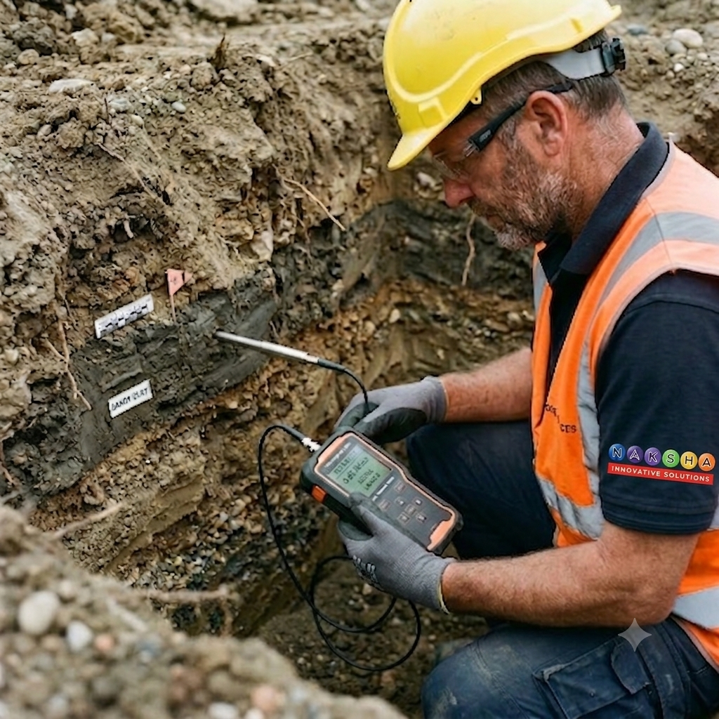
Soil thermal resistivity is a critical factor in solar park development, directly influencing the efficiency and longevity of buried electrical and thermal components. At Naksha Solutions, we provide specialized Soil Thermal Resistivity Testing to assess the soil’s ability to dissipate heat, which is crucial for the safe and effective operation of underground cables and other thermal infrastructure.
In solar parks, underground cables carry electrical loads that generate heat, which needs to dissipate effectively to avoid overheating. High soil thermal resistivity can trap this heat, leading to reduced cable efficiency, increased energy loss, and potential thermal failure. Testing soil thermal resistivity helps optimize site planning by identifying areas where soil treatment or specific cable layouts are required to enhance cooling and maintain energy efficiency.

Hydrographic survey/ Bathymetry Survey for Floating Solar Projects

Bathymetry, the science of measuring underwater depth and mapping underwater features, provides essential insights for project execution:

  • Underwater Topographic Analysis: Identifies underwater ridges, slopes, or submerged obstacles that could impact anchoring.
  • Water Depth Assessment: Helps determine the placement of platforms and ensures safe clearance for submerged components.
  • Safety and Risk Management: Evaluates water depth for flood preparedness, ensuring long-term operational stability.

Naksha solutions provide bathymetry survey services with precise bathymetric data collected through sonar  technology, EPC and designer can make informed decisions for platform design, anchoring, and installation processes of solar panel of waterbodies like ponds, dams, etc.. .This ensures not only operational efficiency but also safety and durability.

Earth Resistivity Test Survey (ERT Survey)

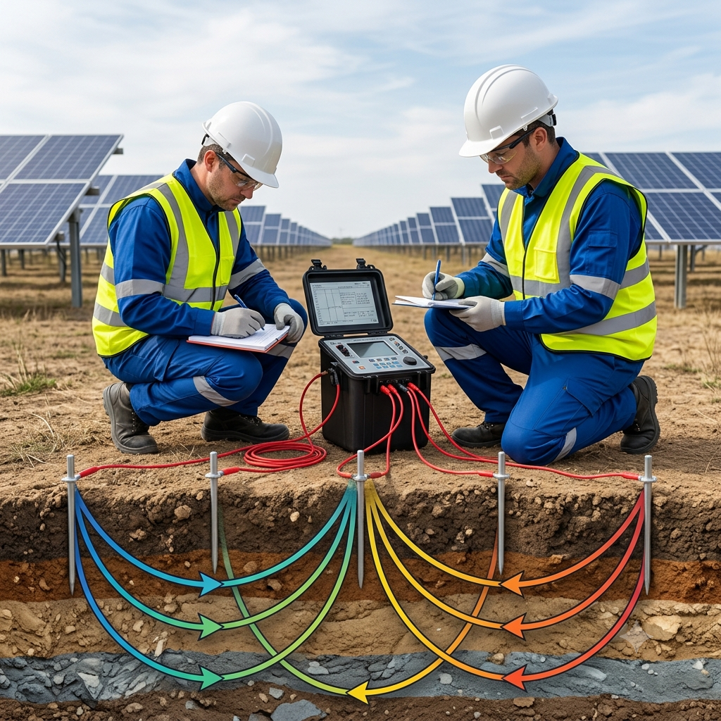
Earth Resistivity Test Survey (ERT Survey) / Electrical Resistivity Tomography (ERT) Survey with Wenner Method and Multi directional (4 direction / 8 direction ) Polar Diagram Analysis for Solar Park Earthing Systems
Naksha Solutions offers advanced ERT services using the Wenner Method and Multi directional (4 direction / 8 direction ) Polar Diagram Analysis to design reliable, efficient earthing systems tailored to solar parks. Following the guidelines of IS: 3043-1987 for earthing practices, our approach ensures precise subsurface resistivity mapping to enhance fault current dissipation.

Key Benefits

  1. Accurate Resistivity Profiles: The Wenner Method provides detailed resistivity data at multiple depths, pinpointing low-resistivity layers optimal for grounding rod placement.
  2. Directional Insights with Polar Diagrams: Polar Diagrams reveal resistivity variations, allowing grounding rods to be positioned along the most conductive paths for maximum fault current dissipation.
  3. Compliance with IS: 3043-1987 and ISO Standards: Our ERT surveys meet the specifications outlined in IS: 3043-1987 as well as ISO-certified protocols, ensuring industry compliance, safety, and quality.
  4. Cost-Effective Design: By targeting low-resistivity zones and optimizing rod placement, we reduce material costs while ensuring safe, durable grounding systems.

Naksha Solutions’ integrated use of the  Wenner Method direction survey and Multi directional (4 direction / 8 direction ) Polar Diagram  Analysis delivers a complete understanding of subsurface resistivity, enabling earthing systems that are safe, efficient, and compliant with IS: 3043-1987.